Wet, Mild Weather Forecast For Inland Northwest
After freezing fog and cold temperatures, it looks like the mercury will rise across the Inland Northwest. Dennis Hull with the National Weather Service said a series of systems set to roll in from the Paficic will bring wetter weather to the area, but what kind of weather, depends where you are.
“It’s going to start out as a mixture, that’s going to include freezing rain for the Yakima, Kittitas and Wenatchee area. Most of the rest of the Columbia Basin should warm well into the 30s today, and then 40s region-wide Thursday through the weekend.”
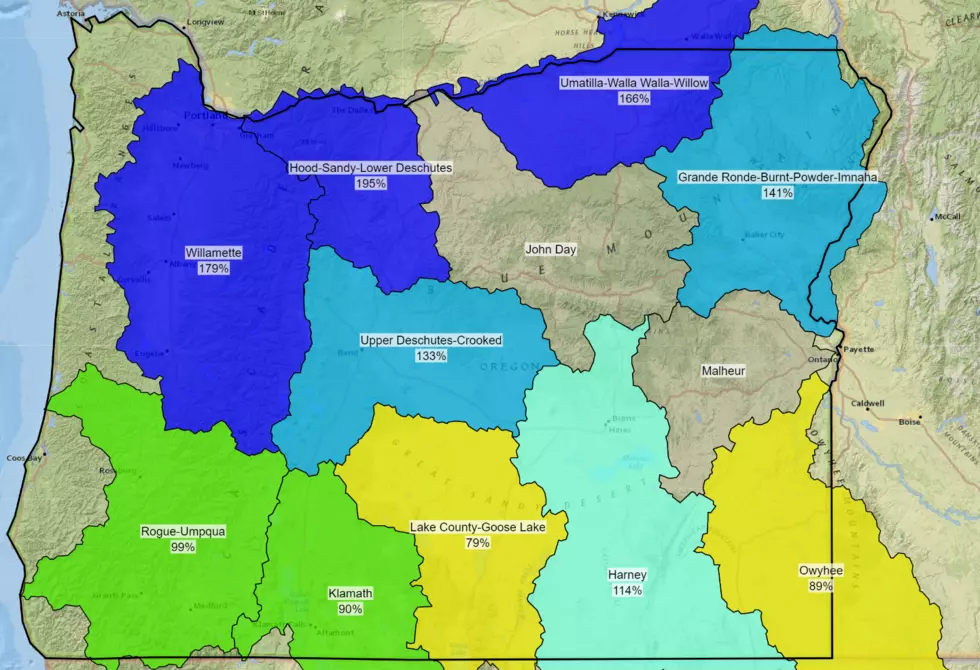
Hull told the Washington Ag Network those elevated temperatures will raise the snow level, which could result in localized flooding, specifically in Central Washington.
“So now, with this rainfall, combined with the snow levels rising to over 5000’, we can expect the snow melt to accelerate, and this may cause some localized flooding, especially north of Prosser, on in to Toppenish, Yakima, and Ellensburg”
Hull said the region could see anywhere from ½” to 1” of rain from this most recent system. But the good news, temperatures should stay mild.
While the temperatures will be close to normal, Hull says livestock owners should watch for increased cold stress on newborn calves, lambs and others.
If you have a story idea for the Washington Ag Network, call (509) 547-1618, or e-mail gvaagen@cherrycreekradio.com
More From PNW Ag Network