
Washington Snowpack Off To A Good Start
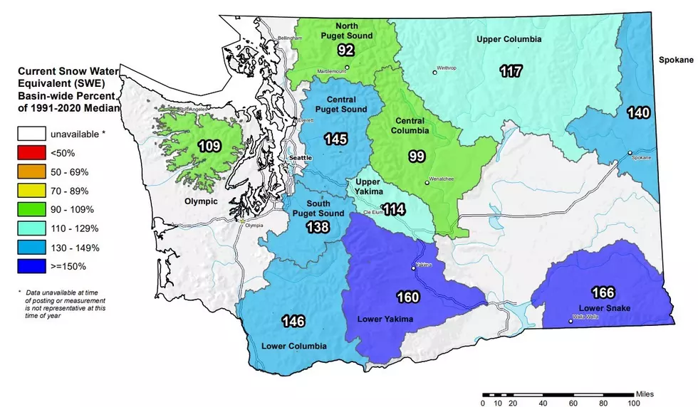
Thanks to several back-to-back systems rolling across the state, Washington’s snowpack is off to a great start. Scott Pattee with NRCS Washington said the current snowpack is 132% of average, and those figures are fairly evenly distributed across the state.
"The highest snowpack in the state is right now is the lower Yakima at 174% followed closely by the Klickitat and the Lower Snake and Walla Walla basins that 170%.”
The snow quality itself looks very good, but Pattee pointed out the dry summer and fall remains a concern for him.
“Year to date from us since October 1, we've only had about 86% of normal total precipitation which means we had a dry fall we had a really dry summer, and so the effect to our soil moisture, storage soil moisture is really extreme this year. Because normally we start getting those small rains before the snow comes, and that really builds are soil moisture back up. And so if we don't build that up, which we really can't now, that a blanket of snow is over the top, then the soil will take its share first when the runoff starts.”
Pattee added he’s hopeful that the storm systems continue to come, and the region does not have the tap turn off, like the state saw in 2021-22, allowing for the snowpack to continue to build.
If you have a story idea for the PNW Ag Network, call (509) 547-9791, or e-mail glenn.vaagen@townsquaremedia.com
More From PNW Ag Network


