Oregon Snowpack Wrapping Up Season On High Note
The 2018-19 snow season for the northwest is starting to come to a close. And while much of the year was dry, the snowpack for Oregon is ending the year solid, leading to above average snowpacks for much of the Beaver State. NRCS Oregon’s Scott Oviatt.
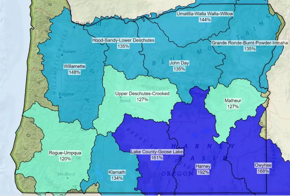
“When we look in the eastern third of the state, especially from Lake County, on up to John Day through the Northeastern part of the Wallowa range, we’re well above normal in all locations.
As far as those basin figures are concerned:
- Umatilla, Wall Walla, Willow – 143% of average
- John Day – 155% of average
- Grande Ronde, Powder, Burnt, Imnaha – 132% of average
- Malheur – 159% of average
- Upper Deschutes, Crooked – 110% of average
- Harney – 133% of average
- Owyhee – 117% of average
But, those large snowpacks aren’t going to stick around long.
“Things are starting to move and we’re starting to see the snow melt turn to runoff which is represented in stream flows.”
Oviatt said the region is roughly two weeks ahead of schedule when it comes to runoff, however, the cooler temperatures expected this week could slow down the process. But he noted, the Northwest needs to hold on to its snowpack as long as possible to help with hotter weather coming within just a few months, or even weeks.
If you have a story idea for the Washington Ag Network, call (509) 547-1618, or e-mail gvaagen@cherrycreekradio.com
More From PNW Ag Network