Lohmann Snow Expected To Stay In Higher Elevations In Coming Days
The weather over the last week has indicated spring may be here sooner than expected. Days after a large snow storm covered much of the Northwest, the region experienced very mild temperatures, melting a fair amount of that snow. And when you mix in the sunshine and windy conditions, the past two weeks have been a mixed bag.
Marilyn Lohmann, meteorologist with the National Weather Service said storms over Valentine’s Day weekend were welcomed news for local snowpacks.
“When we look at the February 1st snow reports for the mountains, most of the places were between 80%-90% of normal. And just by looking today, they’ve been well boosted up to about 120%-130% of normal.”
Lohmann acknowledged while some locations saw a lot of snow with good moisture content, others missed the mark.
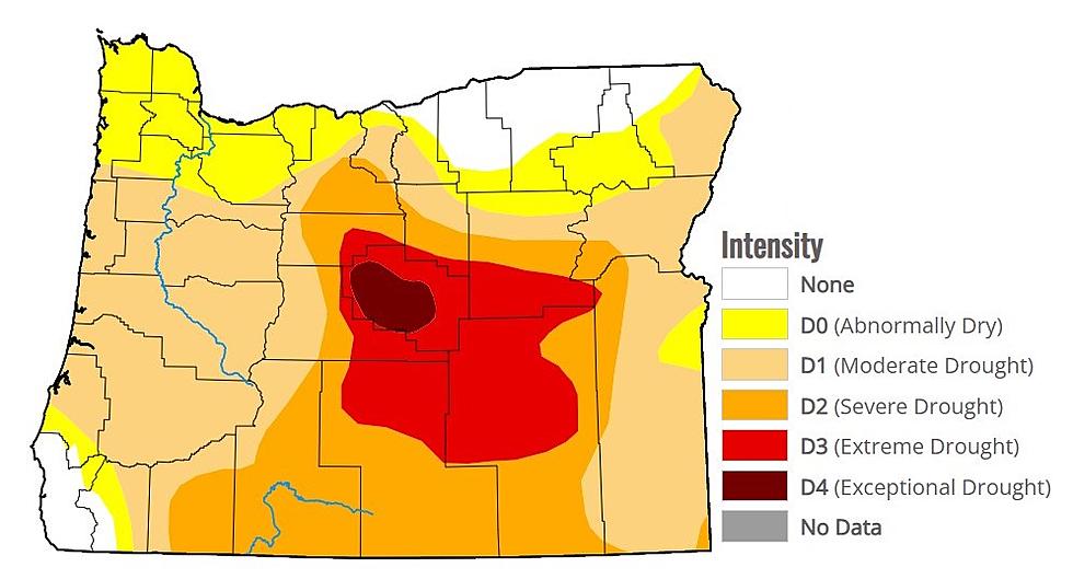
“Some of the places down in southern Oregon and the southern [Oregon] Cascades didn’t do as well. But definitely the northern Oregon Cascades and the Washington Cascades, and the Blue Mountains have gone above, and have moved into the above normal, not well above normal but just a good amount of snow for the mountains.”
Despite the snow, some locations are struggling with low soil moisture numbers. Lohmann added as we prepare to wrap up February, she’s expecting below normal temperatures with below average perception.
If you have a story idea for the PNW Ag Network, call (509) 547-1618, or e-mail gvaagen@cherrycreekmedia.com
More From PNW Ag Network


